Sarstoon Again: Flags, Phones, and a Border We Still Don’t Police Properly
By: Omar Silva I Editor/publisher
National Perspective Belize
Belize City: Monday, 15th September 2025
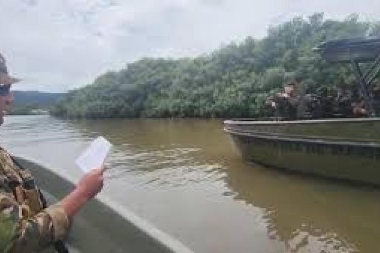
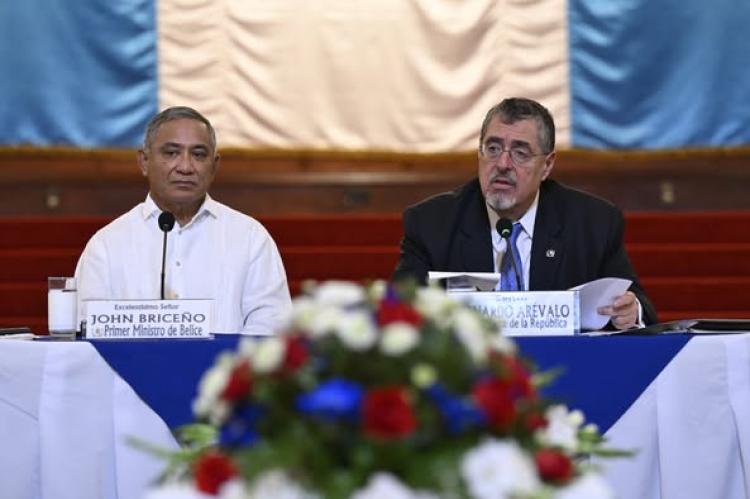
On the eve of Belize’s patriotic season, the Sarstoon flared—again. Videos showed tense exchanges between Belize Defence Force (BDF) personnel and the Guatemalan Navy after a Guatemalan flag was mounted on Sarstoon Island. Belmopan filed a formal protest; high-level calls followed; Guatemala confirmed the flag was removed. Both sides pledged to craft a coordination mechanism to prevent repeats. The headlines cooled; the river did not.
Guatemala’s Army downplayed the moment as “nothing new,” saying patrols will continue while both countries await the ICJ decision. In its telling, repeated standoffs are natural by-products of a still-unsettled “territorial, insular and maritime” case. That framing is familiar—and precisely why a real, public Sarstoon operating protocol is overdue.
“Flags rise and fall in minutes. Procedures last.”
The Rule That Actually Decides the Island
Belize’s legal footing is clear. Article VI of the 1859 Anglo-Guatemalan Treaty sets the Sarstoon boundary along the main navigable channel (thalweg) and assigns any islands to the state on whose side of that main channel they lie. Both sides’ vessels retain free navigation. That’s the black-letter law at the heart of the Sarstoon.
Crucially, the boundary wasn’t left as theory. In 1861, joint commissioners surveyed the Sarstoon, produced a signed map, and recorded that the main stream runs south of Sarstoon Island—placing the island on Belize’s side under the treaty rule.
Later, the 1931 Exchange of Notes documented boundary work (including Gracias a Dios on the Sarstoon) and recognized permanent marks—part of the chain of evidence Belize carries into court.
Why We Keep Seeing the Same Movie
If the law is straightforward, practice on water isn’t. The Sarstoon’s channels shift; boats close fast; crews read different charts; and symbolism plays well on social media. In September 2023, Belizean civilians planted flags near the mouth/islet; Guatemalan Navy units removed them, calling the points Guatemalan waters. In September 2025, the choreography inverted: a Guatemalan flag went up on the island; Belize protested; the flag came down after calls. The river remains a stage.
A workable coordination mechanism has been promised before. Under OAS Confidence-Building Measures (adopted in 2003 and updated in 2005), both states recognized the need for incident verification and calm handling in the Adjacency Zone. In 2016, with Washington and the OAS at the table, Belize and Guatemala began negotiations on a Sarstoon cooperation mechanism—but no public, final text followed. We’re back at that same crossroads.
“We don’t have a Sarstoon problem. We have a no-protocol problem.”
What They Agreed Last Year—And Why It Matters This Month
In August 2024, leaders in Guatemala City pitched “trust-building” ahead of the ICJ ruling: labor/migration tables, tourism link-ups, an update to the Partial Scope Agreement, security coordination under CBMs, and an energy interconnection roundtable. They also said they would abide by the ICJ judgment and expected a decision in 2025 (subject to the Court’s calendar). Good signals—but nothing in that list substitutes for published river rules.
What Must Be Signed—and Shown—to the Public
A real Sarstoon operating mechanism should include, at minimum:
- Shared operations map reflecting the treaty rule and up-to-date hydrography (what both helmsmen actually see).
- Standard radio hailing (channels/call signs/scripts) and right-of-way procedures.
- Incident hotlines (ops-to-ops and MFA-to-MFA) with a 60–90 minute window to defuse standoffs.
- Civilian rules of the river (visits, ceremonies, flag etiquette, and responses).
- Joint incident notes to the OAS within 24 hours; public within 72.
- Periodic joint briefings so both populations hear the same procedures—not dueling rumors.
Absent this, the cycle persists: a flag goes up, a video goes viral, escorts and blockings follow, and carefully worded communiqués buy calm until the next boat meet.
The “Rule of the River”
What the 1859 Treaty says (Article VI):
- The Sarstoon boundary follows the main navigable channel.
- Islands belong to the side of that main channel.
- Free navigation for vessels of both states in the river channels.
What the 1861 survey recorded:
- Joint commissioners surveyed and signed a map on 13 May 1861; the mainstream is south of Sarstoon Island, placing it on Belize’s side under Article VI.
What 1931 added:
- An Exchange of Notes acknowledged boundary work and permanent marks at key points (including Gracias a Dios on the Sarstoon)—part of Belize’s evidentiary chain.
Why a protocol matters even before the ICJ rules:
- CBMs (2003/2005) envisage calm verification and procedures; the 2016 talks to cooperate in the Sarstoon show both sides already recognized the need. A signed, public mechanism turns principles into predictable conduct.
Bottom line for Belize
Belize’s claim over Sarstoon Island is grounded in treaty text and historic demarcation. But claims don’t police rivers; procedures do. Until Belize and Guatemala sign—and publish—a Sarstoon operating mechanism with maps, radio rules, and incident hotlines, the island will keep serving as a stage for patriotic choreography and dangerous close-quarters encounters. The week’s quick de-escalation is encouraging. The test is what gets signed, shared, and actually used the next time two boats meet in the current.
- Log in to post comments


